Friday, March 15, 2013

Kampong Thom and Sambor Prei Kuk

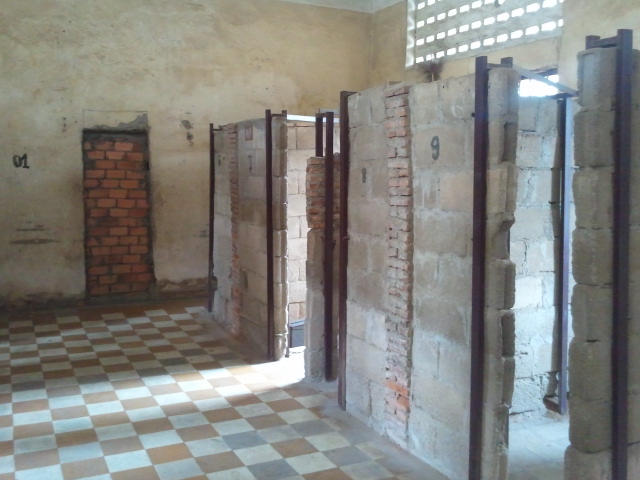
About midway between Phnom Penh and Siem Reap along Highway Six, lies the small provincial town of Kompong Thom.  Kompong Thom is fairly sleepy apart from the buses whiping through en route between two of Cambodia's major destinations and those few tourists who, like us, have stopped off to see the 7th century pre-Angkor ruins of Sambor Prei Kuk which lie about 30km to the northeast of town along some charming country roads.

The drive along elevated highway 6 is, in itself, absolutely stunning. Not far out of Phnom Penh, you already find youdself surrounded on either side by bamboo houses soaring high on their stilts and dry season floodplain agriculture characterized by endless rice and lotus fields. Indian cattle with their characteristic neck humps saunter lazily across the road, blocking traffic composed of tuk-tuks, motos and flatbeds crammed with everything imaginable (and people on top), vans acting as share-taxis and the odd inter-city bus. In areas where the road crosses a river or flooded plain which has not yet dried up, locals poll along on punt-like canoes and live in floating houses along the banks. I so wish I had a picture on my phone to share! This scenery becomes even more intensified along the red dirt backroads that are best experienced by bicycle, moto or tuk-tuk. Added to this, is the fact that people in Kampong Thom were among the friendliest (among the already super friendly Cambodians) we met, with all of the children eager to say hello and breaking out into beautific smiles when we responded in kind as we went past.

One of the tree covered towers in the North Group which I may or may not have enjoyed exploring thoroughly.
Sambor Prei Kuk itself was also fun to visit. Much less touristed than its younger, Angkorian cousins to the north (I think we saw maybe 5 other tourists the whole time we were there), the North and South groups were built by the Chenla-era king Isanavarman I in the 7th century AD and still boat beautiful carved reliefs of 'flying palaces', while the central tower is all that remains of the slightly younger Central group. All of these groups acted as important temples in the Chenla area capital of Ishanapura.

Our guide through the ruins was a former monk who now volunteers his time teaching the local kids English and getting them to help pick up trash and keep the surrounding area clean. While I loved the country feel of Kampong Thom, I worry it might soon change as they are looking to add Sambor Prei to the list of World Heritage Monuments which will wrest control of the tourism industry away from the locals.

Tuesday, March 12, 2013

Phnom Penh & The Khmer Rouge Killing Fields

Seeing all the warm smiling faces of the people in Cambodia, it is hard to believe that the country experienced what was effectively a brutal genocidal war led by a homicidal regime that had Khmer (the Cambodian term for their people) killing Khmer less than forty years ago. An estimated 2 million people - out of a population of only 8 million - died, either from starvation, sickness, or outright murder, under Pol Pot and the Khmer Rouge. That's a quarter of the population gone in less than 5 years (1975-1979) - 5 years! . The scariest part of this? The Khmer Rouge were recognized as the legitimate government of Cambodia and allowed to keep their seat at the UN despite all of this until 1987, as western governments were loathe to lend their support to the Vietnamese backed opposition.

As a fair warning, much of what I'm about to type (and the photo captions in particular) will be upsetting - and it should be. Cambodians say that it is their duty to remember and educate so that nothing like this ever happens again.

The Victims Memorial Stupa at Choeung Ek Genocidal Centre - also known as 'The Killing Fields' just outside of Phnom Penh. Although by no means the only such site, this one is the biggest and most well know, with 8,985 corpses found in in the 86 (of 129 total) mass graves excavated. As bullets were expensive, many were killed with blows to the head from a hammer. Children were smashed against trees, women stripped of their clothes, and 'traitorous' Khmer Rouge cadres were beheaded. As numbers increased in later years, many were not even killed outright, but pushed into pits, covered with DDT and left to rot. To make matters worse, many victims killed at Cheong Ek had already been held and tortured at the notorious Security Prison 21.
First, a quick run down of recent Cambodian history for context. After being home to a great civilization, which, at it's height, covered nearly all of Indochina, from about AD802 until AD 1594 when Siam finally captured the capital, Cambodia became somewhat of a vassal state, subject to tributes demanded by invading Siamese (Thai) and Vietnamese forces. In 1863, King Norodom was forced to negotiate away mineral and timber rights to the French in exchange for military protection from Cambodia's neighbors. In this trade, France also gained the right to chose Cambodia's future kings. In 1941, shortly before the outbreak of WWII and invasion by Japan, 18 year old Prince Norodom Sihanouk was chosen in place of his farther. After the war, whilst France was occupied with the rebellion in Vietnam, King Sihanouk was able to successfully negotiate for his country's independence - officially granted in May of 1954. At this point, Sihanouk abdicated, appointed his father as King, and chose to run in the elections. His party won every seat. However, in 1960, when his father died, Sihanouk appointed himself 'Chief of State', effectively remaking himself king and causing some unrest. Around this time, Sihanouk also tacitly agreed to allow the Viet Minh to establish some of their bases along the border in Cambodia, prompting a rash of fly-over bombings by the US in those areas and his eventual deposition by Prince Sisowath Matuk and General Lon Nol in 1970 while he was out of the country. Whilst in exile, Sihanouk initially lent his support to a supposed rag tag group of communist farmers called the Khmer Rouge, encouraging his people to go out to the jungle and fight for their country. Sadly, all of this culminated in a civil war which led to the eventual take over of the country by the Khmer Rouge in 1975. Tragically, this war would not come to an end until 1998, after defections by high level Khmer Rouge and the death of leader Pol Pot. Even more tragically, the country is still home to a great deal of unexploded ordinance (such as landmines) bringing remnants of the horrors of war into the present day.


One of the torture chambers at S21 (Security Prison 21) in Phnom Penh - now Tuol Sleng Genecidal Museum.  Prior to its use as a detention and torture centre, Tuol Sleng was actually Tuol Svay Primary and Secondary School. This was a classroom. When the Vietnamese arrived they found 14 severely decomposed bodies in each of the torture rooms.

Although the Khmer Rouge were initially welcomed with open arms when they marched into Phnom Penh on April 17th, 1975, emotions changed rapidly when all of the city's population - including the old and the sick - was forced to march out into the jungles and begin a life of farming devoid of any outside aid. The vision of the (largely French educated) Khmer Rouge inner circle, was to abolish education, hospitals, religion, technology and all forms of knowledge, turning their country into a 'self-sufficient agrarian paradise' (ring any bells?). As people - including children - were forced to work in the fields with little or no food, true medicine or relief day in and day out, many died. Still more were outright killed or forced into battle. Although it was only intellectuals (including anyone who wore glasses), government workers and Lon Nol soldiers who were initially killed, numbers rose drastically in later years as Pol Pot became more and more paranoid, killing off anyone he thought might oneday pose a threat - including his own troops.

Bricked up prison cells, normal prisoners were held here and tortured for 2 to 4 months, political prisoners 6 to 7. An estimated 20,000 people passed through Tuol Sleng en route to their deaths. Between only  7 and 21 people are known to have survived. Two of these, Bu Meng and Chum Mey, now in their 80s, volunteer at the museum, selling their memoirs and discussing their memories. Of the survivors, all have forgiven their day to day captors, many of whom were forced to preform their duties - and some of whom even had to watch their parents go to their deaths. Kaing Guek Eav, or Duch,  the former head of S21and the first of the former Khmer Rouge leaders to stand trial for war crimes, has also said that those under him cannot be blamed, taking upon himself full responsibility for the atrocities carried out under his directive at Tuol Sleng and the Choeung Ek Killing Fields.

Brought into the fray by raids across it's borders, liberating Vietnamese troops finally marched into Phnom Penh and the greater countryside in 1978, setting up a government with Khmer Rouge defector Hun Sen at it's head. After many years of vicious fighting, particularly in the Thai border regions where the Khmer Rouge had fled, a UN Transitional Council was set up to aid the country in holding elections which boasted a 90% turnout in 1993. Although Prince Norodom Rinariddh's FUNCINPEC party appeared to have won, he was forced into a coalition with Hun Sen's Cambodian People's Party by Hun Sen. In some form or another, the two men have been leading the country ever since. It should be interesting to see what this year's up coming elections hold. 

1993 also saw the re-coronation of the still much beloved King Sihanouk - this time as constitutional monarch. Despite Cambodia's turbulent recent history and his role in it, King Sihanouk's loss was heavily mourned by his people when he passed in October of 2012. The current King, his youngest son, Norodom Sihamoni, who was appointed by council upon Sihanouk's medically-prompted and unexpected (second) abdication in 2004, also appears to be well loved by his people - he's also the only siting monarch who speaks Czech and is a former classical dancer. Both are wins in my book.

Chum Mey's cell. To give some idea of the horrendousness of the conditions, in his memoir, Chum Mey writes this about his visit to one of the Nazi Concentration camps as a tourist later in life: "When I was taken to the camp, I thought of Toul Sleng. There was the same kind of killing at these two places. [...] It was also different from Tuol Sleng because they had many beds and didn't have to sleep on the floor. They could bathe, too, so Tuol Sleng was worse." (Chum Mey, 2012 p.44)

For more information on life under the Khmer Rouge and the slow process of bringing the perpetrators to justice, check out:
First they Killed my Father: a daughter of Cambodia remembers by Loung Ung
When the War was Over: Cambodia and the Khmer Rouge revolution by Elizabeth Becker
Survivor: the triumph of an ordinary man in the Khmer Rough Genocide by Chum Mey
Choeung Ek's Website (www.eccc.gov.kh/en)
The Tribunal Website (www.cambodiatribunal.org)

Thursday, March 7, 2013

Phnom Penh

With its wide tree-lined boulevards, smiling friendly people, overabundance of tuk-tuks (motor cabs), magnificent mix of traditional Khmer and old-school French colonial architecture, and hodge podge of vendors, Cambodia's Phnom Penh exudes a unique sort of charm that is all its own.

Thus far, I've loved what I've seen of the city that was home to such great sufferring not so long ago. This place truly comes alive in the early evenings - particularly now as it's hot season. Sadly, my picture of the late afternoon traffic circling the National Independance Monument really doesn't do the city justice. Hope you enjoy it anyhow - that's one of Phnom Penh's many Wats (temples),Wat Lanka, in the background on the right.

Tuesday, March 5, 2013

Farewell Gwangju

Sadly, all good things must come to an end. Time's come to say Goodbye Korea, Hello world. I am really going to miss this place! 

A picture of my empty classroom *sniffles*

안녕히계세요! Until next time!

Tuesday, February 19, 2013

Muju! Skiing Korea

This past New Years Day (the Gregorian New Years of about a month and a half ago that is, not the Chinese New Year that took place this past weekend), I decided to take advantage of both the snow squall and the day off work to partake in one of my favourite activities, and one which has become somewhat of a New Year's tradition - Skiing!!!

Teaching the beginners at Muju.

Friends of mine had heard of a fairly cheep bus service, lift ticket and rental package (of both winter clothes and skis/boarding gear) all for under 100USD to the nearby resort Muju (무주) on Mt Deogyu (덕유산). Although not a huge mountain (Deogyusan's highest peak is at 1,614m, but the resort does not extend that high up), Muju has 34 runs -  including a few nice long ones down from the resort's highest peak (the longest is 6.1km) - and provides great skiing for those at the beginner and intermediate levels. It's not phenomenal for advanced skiers, but the harder runs (steepest is 60degress) do offer up some fun. It's central location on the peninsula also makes it easily accessible from just about anywhere in Korea.

As we went during a snow storm, we were also blessed with some great snow - which felt a lot more like biting ice in the high winds at the top. Nevertheless, we had a thoroughly enjoyable day on the slopes - made even better by the fact that Muju is open early until late! I have to say, there is definite merit in a ski hill that has its lifts open from 6:30 in the morning until 2am the next. Definitely my kind of hill!

A nicely frosted pagoda up at the top.
Anyone living in Gwangju who is looking to head over to Muju should check out (or have a Korean speaker check out) the packages here. You can also call 010-3648-7761 (Korean only). Muju's website can be found here (English option at top right).  

Volcanoes in the Snow - Hiking Hallasan

Truth be told, while I was eager to enjoy the other delights the Island has to offer, my primarily reason for visiting Jeju (and that of my companions as well) was to hike Hallasan (한라산) and complete the Korean hiking triumvirate of Jiri, Sorak & Halla.

Looking toward the peak from the Sara Crater detour.
Although Hallasan, at 1950m, is the tallest of Korea's three major mountains - and, indeed, of all of Korea's mountains - I would say that it offers the easiest hike for it's size.

My companions en route - these two are off to Nepal next - sooo jealous!
Quite possibly the best sign ever. We found this one on our route down.

Hallasan is home to a number of trails, only two of which reach all the way to the top. The 9.6km Seongpanak (성판악) route on the eastern side of the mountain, winds it's way mostly through the trees, providing a nice, gentle ascent. The 8.7km Gwaneumsa (관음사) route on the northern side by contrast, is a stunning but narrow trail with a great many stairs and a number of ups and downs. Knowing this, we chose to take the gentler route up and the harder route down. This proved to be a wise decision as most of the Koreans who went all the way to the top, also chose this route. 

Walking through trees on the Seongpanak ascent.
Our route choice proved to be a good one for another reason as well. About halfway up the Seongpanak route there is a 45minute detour to Sara Crater Lake (사라 오름-Sara Oreum) and a lookout point. Although the clouds mostly obscured the view from the lookout point, the crater and it's frozen lake made quite a pretty sight. 

the boardwalk lining Sara Oreum
Overall, the hike was absolutely gorgeous - possibly made even more so by the snow. We were also lucky in that we had a gorgeous clear day (above the cloud line that was) and not too much of the blustery wind that Jeju is so famous for. It should be noted that if you are planning to hike it in winter, cramp-ons are an absolute necessity (particularly on the way down). We picked ours up at the Seongpanak park entrance for about 10,000won ($10US). Nicer, more expensive ones were also available.

Windswept snow at the top.
More proof of Jeju's strong winds. This is on the northern side.
A further note for any planning to hike to the top - there are checkpoints on the mountain that you must pass by a certain time in order to be allowed to continue. A time sheet (along with route info) can be found here. We started off from the base at around 8:30 and had no trouble reaching the upward checkpoint by noon, even with our detour. The full round trip (with some rest time at the top and one of the shelters further down) took us until about 5pm at a moderate pace.

Up at the top.

Not what you expect from the peak of a volcano!

Monday, February 18, 2013

Jeju Island: Exploring a Gem of the Pacific

Last week, two friends and I decided to take advantage of our final long weekend in the country during Seollal (설날) - also known as the Lunar New Year - and hop on a ferry to what is reputed to be the most beautiful place in all of Korea - Jeju-do!

Recreations of the famous Jeju hareubang statues.
For those who don't know, Jeju (제주) is a small (73km by 41km) oval-shaped volcanic island 130km off the southwest tip of the Korean peninsula. Famed for it's beauty and often called 'the Hawaii of Korea', Jeju was recently named one of the New 7 Wonders of the Natural World - and I have to say, even in winter, Jeju lives up to it's hype.

Exploring the rock formations on the southern coast of Jeju.
While the 2 million year old island is literally littered with mini extinct volcanoes (360 of them to be exact), volcanic craters and lava tubes surrounding the main volcano of Hallasan (한라산) - also Korea's tallest mountain, coming in at 1950m (more on that in the next post!) - these are only part of what make the island so spectacular.

In addition to having a unique geology, Jeju's relative isolation has given it a unique cultural history. While Jeju was eventually annexed by the mainland Goryeo Dynasty in 1105 and the Mongols after that, then returned to Korea with the takeover by the Joseon Dynasty (who used it as a place to send political exiles) in 1404, and thus has shared much of it's more recent history (such as Japanese occupation) with the mainland, prior to this, Jeju-nese history is somewhat of a mystery.

Cheonjiyeon Falls (천지연 폭포) from a distance. You can see Hallasan rising into the clouds on the right.
Very little is known about the pre-Goryeo Tamma Kingdom and how it came to be. Island legend states that the three demigods: Go, Bu and Yang, rose out of the ground and became the islands first residents. When the three men were out hunting one day, they ran across three princesses who had washed ashore with all of their agricultural accoutrements and livestock. Marrying these three women, the hunters settled down and established the three main agricultural clans of Jeju island. The hole in the ground from which the hunters emerged can still be visited at Samsunghyeol Shrine (삼성혈)- which remains an important location for the seasonal ancestral rites performed by their descendants - in Jeju City.

A stone ring and tripple alter surround the hole through which Go, Bu and Yang entered Jeju at Samsunghyeol.
Other unique features of Jeju-nese culture include thatched roof houses - although these can only be seen today in the preserved traditional 'folk villages', the inexplicable ancient basalt mushroom-like grandfather statues called Dol Hareubang (돌 하르방) which dot the island, the hand-stacked stone dividing walls to allow for Jeju's famous winds to pass through without toppling them and, last but certainly not least, the haenyeo (해녀) - Jeju's famous women divers. Although now somewhat of a dying breed, women began to do the work of diving into the waters along the coast to collect shellfish in the 19th centuries when their husbands discovered that their families would be tax exempt if they did so!

As interested as I am in culture, as much as I loved hiking Hallasan and as fascinating as the publicly accessible portion of the lava tubes at the UNESCO World Heritage Site of Manjanggul (만장굴), geologically speaking, it was the coastline that took my breath away!

Looking toward Munseom (island) from some of the Rock formations along the coast in Seogwipo.
While the northern coastline around Jeju City (제주시) has some fun rocks, it's the south near Seogwipo (서귀포) that is really stunning. Not only is the area around Seogwipo studded with waterfalls, to the West of the city lies the resort area of Jungmun (중문), home to Korea's Jusangjeolli (주상절리) or  'Black Beach', made of hexagonal basalt formations reminiscent a smaller version of the Giant's Causeway connecting Scotland and North Ireland. While Jeju's Jusangjeolli is not as large as the Giant's Causeway, the emerald blue (no, really, that's the only way to describe the colour!) water the rocks rise out of makes it breathtaking to visit.

Jusangjeolli. The colour of the water made me nearly desperate to jump in - and it was February!

Jungmun is also home to Yakcheon Temple. While I have seen a lot of temples during my time in Korea, Yakcheonsa is ranks up there with my favourites. Done up in a more ornate style that reminds me more of the temples I've seen in Taiwan than any I've seen in Korea, the combinations of pastels and golds, as well as the amazingly detailed latticework carvings on the windows made a visit well worthwhile.

The bell tower at Yakcheonsa with oranges in the foreground. In addition to being famed for it's beauty, Jeju is famed for the deliciousness of it's oranges. Sadly, I was there a month too early for these ones to be ripe.

The giant gold Buddha inside Yakcheonsa. The great hall is said to be one of the biggest in Asia. With three floors of viewing galleries, each surrounded with painted panels depicting stories, I may well believe that.
Even further to the west along the southern coast was quite possibly my favourite spot on the island - the Yongmeori (용머리 - dragon's head) Peninsula. While it's invisible until you are down there and closed off at high tide, the coast below Sanbang peak (삼방산) if formed of weathered vocanic cliffs and caves that just bed to be explored. This is also where the monument to Handrick Hamel - the Dutchman who washed ashore on Jeju in 1653, was captured and enslaved, eventually managed to escape with 7 others in 1666, and wrote a book bringing news of life in the Joseon-era Hermit Kingdom of Korea to the rest of the world - and recreation of his ship are located. The small Mt. Sanbang itself is also worth a visit as it is home to Sambanggulsa (삼방굴사) or Sambang Cave Temple.

Looking toward the Yongmeori Coast from Sambang Temple. Hamel's ship is just visible in between the temple and coast.
A view of Hamel's ship through his momument.

While Jeju is fairly small, the sheer number of protruding mini volcanoes can make getting around the island somewhat time consuming. It's possible to travel by public transport, but having a car (and in smaller areas, bikes) might be more convenient (you need an international drivers licence though). We were lucky enough to stay in a wonderfully accomodating hostel (the owner even fed us traditional New Year's Tteok-guk (rice cake soup) on Seollal!), which offered cheap tailor-made driving tours. You can check out B&B Pan here. The island is also crisscrossed by 'Olleh Trails', 200km of connecting walking trails which have been divided into 13 different routes - although on many you can jump it at any point along the path.

Looking back toward Sanbang while walking the coast.

Some of the formations on the Yongmeori coast. This one is about three times my height.

Some more of the crazy geological features.
There are a number of ways to get to Jeju. Flights leave from most of the larger city airports on a daily basis and ferries, from Incheon (Seoul, 14hrs), Mokpo (4hrs) and Wando (3hrs), to Jeju City on the North Coast leave just as frequently. The fastest Ferry, and the most convenient for us, is the JH Ferry run by Orange1 which leaves from Jangheung (장흥), near Yeosu in southern Jeollanamdo, and arrives at Seongsan (성산) on the west coast of the Island in 2 and a half hours. There is also a free shuttle bus run by the ferry company which connects Gwangju to Jangheung. Their website is here. Unfortunately, it is entirely in Korean.

A view of Ilchulbong (일출봉), or Sunrise Peak in Seongsan on the East Coast at Sunset.