Being me, one of the main objectives of my going to visit Cambodia was to see the Angkor ruins up near Siem Reap. Although most people are aware of the World Heritage Site (and Wonder of the World) that is Angkor Wat, few are aware that the Angkorian ruins in the area cover hundreds of square kilometers, with many ranging even further afield. The Angkorian Empire (AD 802 -1431) did, after all, at it's height cover all of what is now Cambodia and Laos as well as most of Thailand and much of Vietnam. Fortunately, my mother, with whom I was travelling at the time, is similarly interesting in archaeology and, so, we not only got one, but three days, to explore the temples in the area - including Banteay Srei to the North and the Roluos group to the East. Sadly we didn't have time to make it to the temples further up the mountains to the north, but they are meant to be especially beautiful in wet season, which it was not. Below is a selection of some of my favourite sites.
Main Site
 |
| One of the five four-headed gates into Angkor Thom. Angkor Thom is the largest of the ruin complexes, covering an area of 9km square and encompassing many other sites within its walls. Definitely a must see. My favourite temple inside was Bayon - imagine a pyramid topped with 54 many-headed towers. The Terrace of the Elephants and Terrace of the Leper King with their many carvings were also nice to see. Angkor Thom itself was built by King Jayavarman VII in the late 12th and early 13th centuries AD and was the last great Khmer (Angkorian) Capital, housing up to as many as a million inhabitants. |
 |
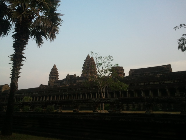
| An end of day photo of Angkor Wat itself. This photo was actually taken on my birthday after I had cycled back up from town to watch the sunset, catching it from the uncrowded back gate. Angkor Wat is the most complete of the temples in terms of what remains. It was built in the mid 12th century as the temple and mausoleum for King Suryavarman II and is home to incredible bas reliefs which cover the hundreds of meters of walls in the first gallery which surrounds the inner temple. As the temple was initially dedicated to Vishnu, the reliefs depict scenes from central Hindu myths such as the Ramayana and the Churning of the See of Milk. |
 |
| A view of the Jungle from atop the towers of the central sanctuary. |
 |
| One of the still red-painted Apsara dancers carved on the walls. Apsara is a traditional Indian-Indochinese dance form with holy connotations for both Buddhists and Hindus in the region and, so, such carvings are found undestroyed on many of the temples. The red colour comes from when all the temples were converted (re-converted in some cases) to Buddhism in the 16th and 17th centuries - long after the area had ceased to be the Khmer capital. ( The capital was moved south after the invasion of Siam in 1431.) |
 |
| Ta Phrom - easily one of my favourite sites as it's so overgrown with massive trees! It was originally built by Jayavarman VII around the same time as Angkor Wat and was dedicated as a Buddhist Monastery. Subsequent (re-) conversion of the area to Hinduism in the period following meant that many of the carved Buddha's on the walls were defaced, destroyed, or turned into Hindu ascetics as at most of the other temples from the period. Based on an inscription at the site, it appears that twelve thousand people lived at the monastery with almost eighty thousand villagers supporting them. |
 |
| Banteay Kdei. Another of my favourites. Dating from the same period and located close to Ta Phrom, but not quite as tree covered, Banteay Kdei is still a lot more rubble-filled and less reconstructed than many other temples. It is also less touristed, giving it a much more peaceful air. |
 |
| Looking down from the top of Phnom Bakheng. Built on top of a small mountain, it is actually the oldest temple at the main site, built by Yasovarman I in the late 8th century AD. As the hill on which it's built rises 60m above the rest of the plain, Phnom Bakheng provides a wonderful view of Angkor Wat and other temples rising out of the jungle as well as of the Tonle Sap lake to the south. Strangely (to me at least as it lies northwest of it) the site gets flooded with tourists in the late afternoon who hike up to watch sunset over the Angkor Wat, leaving it nearly empty in the early morning and throughout the day. |
North Group
 |
| Banteay Srei might be one of the prettiest of the Angkor Temples. Built in the 10th century, it;s like a pink sandstone, much more delicately carved version of some of the later temples. Definitely worth visiting (possibly after you've seen the others so that you have something to compare it to), it lies 30km north of the main sites through some great countryside (I wouldn't recommend cycling it (we certainly didn't) unless you have a lot of energy and most of the day). The Mine Museum is also on the way. |
Roluos Group
Before the capital was at Angkor, it was a dozen or so kilometers east of Siem Reap at Rulous. The Rulous group is now comprised of three main sites: Lolei (not pictured here but which sports adorable tufts of hair-like grass on top of its four towers and is home to a Buddhist monastery, orphanage and language school), Preah Ko and Bakong.
 |
| Built as a Hindu funerary temple for his ancestors by Indravarman the first, Preah Ko is a fairly small site. The best part about it is Dy Proeung's stone carving workshop opposite. A master architect and carver who survived the Khmer Rouge purgings, now 80-some odd year old Dy Proeung has carved miniatures (which are still several meters large) of many of the main temples. He was even recognised by the former king for his work. Go visit him. |
 |
| On of my favourite of all the temples, this is Bakong (with my mother in the foreground). The oldest 'temple mountain' (pyramidal temple) in Cambodia, it has some delightful statues, nice crumbly bits, a lovely moat, beautiful flowers, stairs on every side and many, many fewer tourists than the other sites. As it's the oldest, the carvings also differ, with many of the women on the central towers doing things other than dance. |
In terms of getting to the temples from Siem Reap. A number of options are available. You can easily hire a tuk-tuk for the day for up to four people (should be around $20-$25 US for the day depending on the number of people and whether or not you are making your poor driver wake up for sunrise), rent motorbikes (not sure of the price), join a tour, or, my personal favourite way as the area is mostly flat, rent a bike ($2-5 US/day depending on the quality) and cycle. Bear in mind that if you are cycling, the closest ruins are 10km from the city (took about 23 mins on a not-great-bike) and cover an area much larger than that - in other words, if you are cycling, bring a lot of water and sunscreen and be prepared to take some rests in the shade. It's also possible to hire guides for the day ($20-25 US for English, other languages are more expensive, add five dollars for sunrise, likely more if you expect them to cycle with you). Most of the local children around the ruins sell knockoff guide books with excellent info in them if you want to do it yourself. Temples are all open 5am - 6pm (except Banteay Srei which closes an hour earlier). Entry to the sites (including the main site, Roluos group and northern groups) is $20 US for one day, $40 for 2 or 3 and $60 for 7, you can enter and exit as many times as you want per day with no penalty.
Siem Reap itself is very much a tourist town, but a cute one for all that. Other things to do are to explore the countryside or take a boat ride out on the Tonle Sap (which floods so much in rainy season that it becomes Asia's largest freshwater lake) to visit the floating villages (be prepared to pay $10-20 US/person).