Saturday, October 20, 2012

Cycling through Fields of Gold: a Visit to the Ancient Silla Capital of Gyeongju Day 1

A few weekends ago, I took advantage of the fact that all of my friends would be out of town or otherwise busy and snuck out to explore the ancient Silla capital of Gyeongju (경주) on my own. While I wouldn't have minded company, it was probably better that I had no one else with me - it allowed me to engage in some hard core archaeophilia without doing so at the expense of anyone else!

A Silla-style pot sits in front of one of the many ancient burial mounds of Gyeongju.
I'd previously heard mixed reviews of the city, and it may be the archaeologist in me coming out, but I absolutely loved it! Fairly small for such a famed city and located nearly on the coast, four hours east of Gwangju, Gyeongju was home to the Silla Dynasty, which lasted from 57 BC to  935 AD, and ruled a unified Korea from the 7th to 9th centuries AD (after conquering the western Baekje Kingdom in 660AD and northern Goguryeo in 668AD). Because of this, Gyeongju is, unsurprisingly, home to a great many Silla Dynasty Treasures - chief among these (in my opinion at least) are the burial mounds.


Hwangnam Daechong (황남 대총), a double tomb likely containing both a king and queen,  located in Gyeongju's Tumuli Park (대룽원 - Daerungwon).

The Tumuli are scattered all around the city, and many of these can be visited for free. The best concentration of these, however, lies within Tumuli Park (entry 1500won, open 9am-10pm). The park is located in the city centre and beautifully landscaped with atmospheric music played on speakers throughout. This is not what makes it worth visiting, rather, it's the access to Cheonmachong (천마총 - or Heavenly Horse Tomb), the only tomb in Korea that visitors are permitted to enter. Named for the design on one of the artifacts found (and now displayed) inside, the tomb likely belonged to a 6th or 7th century king. I know I may be a bit biased, but it is definitely worth it. The reconstruction of the burial as it was found, as well as the richness of the artifacts on display are wonderful. It's also worth visiting if only to get some idea of just how astonishingly big these tombs are inside!

The entry into Cheongmachong. No pictures of the inside. I was far too distracted by the actual contents and it felt a bit disrespectful to be taking any. Definitely worth a visit though!
As many of the city's main sites are located within a 3km2 area (and the not-so-main-ones within 10km2), the best way to visit them (in the spring summer and fall at least) is on foot or by bike (available for rent at the bus station for 7000won/day or south of Tumuli park for 5000/2hrs or 10,000/slightly longer day).  There really was loads to see but, rather than overwhelming you with photos of (some might say far too many) tomb mounds, farmers fields, museum displays and archaeological sites, I figured I'd only post a few.

Possibly one of the most famous sights in Gyeongju, Cheomseongdae (첨성대) is an astronomical observation tower built during the 7th century reign of Queen Seondeok and located in what is now Wolseong Park. It is lit up particularly nicely at night.
The tree covered rise in the background is all that remains of Banwolseong (반월성 - literally Half Moon Fortress) or Wolseong Palace. The hill is now home to lovely walking and cycling paths and not much else - well, except for the ice storage celler which has mysteriously survived.


The Emille Bell at the National Museum. Known as the Bell of King Seongdeok, this bronze bell weighs at least 19 tons  making it one of the biggest not only in Korea, but the world. It dates from 771 AD and legend has it that when it was first cast, it wouldn't ring - or at least not until it was melted down alongside the body of a young girl and the mixture recast. That's why, when rung, the bell makes a sound like 'emille' (pronounced like Emily), the word for mother in the Silla dialect.

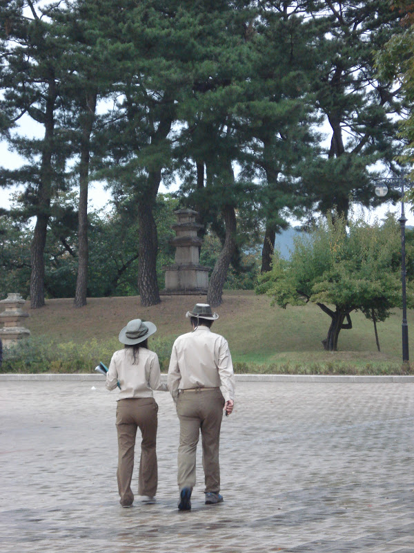
Two of the Museum's workers wander the grounds. A picture of archaeological delightfulness I just couldn't pass up - I don't ever recall dressing like that :P.
The remains of a Silla necklace. Silla could easily be renamed the golden kingdom. This is nothing compared to the many pure gold crowns and other pieces of jewellery housed at the museum. There is also a wealth of pottery (including duck shaped pots!) and weaponry there from a period spanning nearly a millennia.  
For all my gaming friends: Why, yes, this is in fact an ancient oak D14! With six square and eight hexagonal sides, this dice was used by nobles in ancient Silla to play what we now call drinking games. Each side contains a command to be performed by the die caster. Check out the commands below. 
Command translations for the die above.
While there is no dearth of sights in the city centre, there were a number of less important, but interesting sounding sites further to the south at the base of Namsan (the montain to the south of the city) that I also wanted to visit. Thus, armed with my trusty steed of a girly pink bicycle (complete with front basket and streamers) and directions secured from the gate keeper at the National Museum - who assured me that it was very far for a girl to cycle at 5km away through many farmers fields - off I went.

Fields of goldenly-ripe rice! One of the reasons I wanted to see the sites of Gyeongju in the fall.

Harvesting the rice! This is a sight to be seen just about anywhere across Korea at the moment.

Rice! With an ancient Pagoda in the background. Cycling the narrow paths through the rice paddies was truly a delight (even when the sky opened up and I got rained on). The only problem was trying to watch where I was going and not veering into the fields looking around me - something that nearly happened more than once...
One of the many smaller sites, Poseokjeong (포석정 -Stone Abalone Pavilion) provides further proof (as if any was needed) that Koreans (past and present) really like their drinking games. Once an Banqueting Villa for the Silla Kings, all that remains is this this 6 meter long trench. In times past it was filled with running water and one person placed at each end. The person at the head would come up with a line of poetry and place a drink in the trench at their end. If the cup got to the other person before they came up with a suitable second line, they were required to down said drink. Sounds like a pretty solid game to me!

More fields. It's silly, I know, (and probably marks me as a city girl as well), but I somehow never clued in that ripe rice would be golden in colour. I always just envisioned it as green!

After finishing my rounds and dropping off my bike, it was time to check out Anapji (안압지) pond at sunset. Here is what I encountered on the way.

What I believe to be the Lotus Flowers Complex at Anapji.
A closer view of one of the hedge flowers.

A Heron! (or is it a stork?) There were a number of these alongside ducks in this part of the park.
The fields at dusk. 
Anapji at night. The reflections just make this look too cool!
A man-made lake first designed by King Munmu in 674 AD to reflect the shape of his kingdom after unification, the location was also the site of the breakdown of the Kingdom as it was here that King Gyeongsun later handed over power to the founder of the Goryeo Dynasty in 918 AD. 
Once a much larger complex, and called Wolji at the time, three reconstructed pavilions are all that remain. Anapji is located directly west of Banwolseong and has provided a host of archaeological treasure, most of which are housed in a special building at the National Museum. 

Friday, October 12, 2012

The Flowers that Were: Bulgupsa


A single Sangsahwa (상사화) flower stands in front of Yeonggwang County's Bulgup Temple (불굽사).
After having seen a number of photos over the past few weeks of friends lounging in fields of vivid pink flowers, two friends and I decided to spend the last day of our long weekend out at the temple where these flowers were supposedly located. 
Bulgupsa
Unfortunately however, we arrived too late. Fields which had, only the week previous, looked like this: 

A photo of sangsawha in full bloom.
looked instead like this:
A field of sangsawha when they're... well... not in bloom.

To make matters even more entertaining, not only were the flowers gone, but temple renovations had just begun!
A half-finished paint job.

A crane stands over Bulgupsa, ready to held the men with the roofing.

Artisans sanding the guardian statues for repainting.

In spite of all of this, we had an absolutely lovely day. The weather was perfect and the temple grounds are not only vast, but they encompass groomed parkland, a reservoir and lovely hiking trails.

A view of the temple grounds.

Some ripe persimmon. I really need to try one one of these days - especially now that they're everywhere!

Our desire to see at least one sangsawha before we left also lead us on a merry flower chase -which mysteriously involved walking the hiking trails despite my having just hiked Seoraksan only two days previous. Here were some of our finds:

Some lovely orange... ... ... yikes... so we can tell I'm not a plant person... species designation anyone?

Not exactly flowers, but beautiful non-the-less.

A new-found friend.


Playing around at the Indian-style pavilion.

Still scouring the grounds. Unfortunately all of these were also dead.

Rice!

We found one! Although it was sadly withered, we knew this meant there had to be more!
Wandering around the reservoir.

Another! This one healthy too!

Trying to capture the magic.

Rising out of the remains of summer.

Look! A whole er...  patch?
Although Bulgupsa is not one of Korea's more famous temples, I think it certainly deserves to be. Not only are the grounds stunning, it was one of the foremost places for Buddhism during the Baekje Kingdom period (particularly around the late 300s AD). The way we encountered (what remained of) the sangsawha was also pretty fitting. The flower is extremely important to Buddhism, symbolising the power of unrequited love, as the flowers and leaves never appear at the same time!
A prelude of what`s to come. The afternoon sun shines down on fields of  ripe golden rice.

Seoraksan & Sokcho - Conquering the Peak

Celebrating Thanksgiving with friends & looking happy after completing 30km-worth of hikes in two days!
As many of you may know, the Korean Thanksgiving & Harvest Festival of Chuseok (추석) fell on the final weekend in September this year. As the date itself fell on a Sunday, we were given the Monday off. Even better, National Foundation Day (개천절 - Gaecheonjal), which celebrates the founding of the ancient Korean state (Gojoseon) in 2333 BC, fell on the following Wednesday. This meant that a number of us were also granted the intervening Tuesday off as a 'sandwich day' - Yipee! :D.

Hilary on the ascent to Ulsanbawi.

A couple of friends and I decided to take advantage of this (extremely) long weekend to head (once more, in my case) as far as we could diagonally across the peninsula up to the northwest corner. This time, however, the purpose of the journey was not to see the sites but, rather, to conquer them - or, more specifically, to conquer Seoraksan (설억선), one of Korea's most famous mountains/national parks.


Ocean views from the short(er) climb (Ulsanbawi)
Seoraksan is not a particularly high mountain (though it is the third highest in S.Korea). It's highest peak, Daechongbong (대청봉), has an elevation of only 1708m, but provides for some amazing hiking and absolutely stunning ocean views. Being generally adventurous, outdoorsy, active people (also people who were unwilling to carry too many supplies up with them ;) ), we decided that we would tackle the 21km (including the ascent, descent down the other side and business of trekking to the mountain from our minbak hostel) in only one day, rather than doing it in two and having to shelter on the mountain. Our route took us through the Cheonbuldeong Vally (천불동게국) over several of the subsidiary peaks (including Socheongbong at 1550m, 10.8km from the Seorakdong (East Seorak) park entrance were we started and Jungcheongbong at 1664m, shortly after that). I'm happy to say that we were successful, completing the entire hike in 10 hours (having left our hostel 3km outside of the eastern park enterance at 7:30am and arriving at the southern park entrance of Osaek (오색- five colours) at 5:30pm). For those of you  planning to do this route (or to explore Seoraksan in general) I highly recommend staying in the minbak hotels (korean style hostels in which you sleep on a mat on the floor) clustered around the Seorakdong  or Osaek park entrances. They`re cheap, plentiful and provide cooking facilities (no ovens). Info centres at both entrances offer trail maps, advice and weather conditions. Seorakdong is best for accessibility to Sokcho, the 'dinosaur ridge' of Ulsanbawi and the cable car, while Oseak provides great accessibility to the peak - though I have to say that that route is much more strenuous, rising the full height in only 5km rather than the 11-13km (route depending) it takes on the other side. The descent to Osaek was by far for us the most difficult part of the trip - both because we knew we were nearly there and because it's just that steep! The nearly 30km we'd hiked up to that point probably didn't help stabilize the legs much either - but I'm getting ahead of myself!
The so-called 'dinosaur ridge'.

Rather than taking the 6-7 hour direct bus up to Sokcho (속초), Korea's northeastern-most city and the one closest to Seoraksan, we decided to break up the journey and head directly north to Seoul first before crossing over eastwards. The reasons for this were manifold. Foremost among these was that this makes the trip strangely shorter (only 5h30 not counting transfer time, but with so many buses a day, that part can be nearly negligible) and, coming in a close second (for me at least!) was that this gave me the chance to attend 5 hours worth of advanced dance class *insert sillily happy grin here*. The other girls took advantage of the time to check out one of the larger climbing gyms Seoul has on offer. I imagine that both of these activities contributed somewhat to our instability on the final descent. None-the-less, for me it was totally worth it!

Looking back toward Sokcho from the Bridges crossing the bay.
Arriving in Sokcho late at night after our exertions on the Saturday, we opted to take a taxi to a local motel (minbak style) rather than walk it. Best decision ever. Our taxi driver was a nearly 90yr old man who had a ridiculously awesome zest for life and was super eager to chat with us once he realized we all (the other two more-so than I) spoke passable Korean. He was downright adorable!

One of said bridges.
While we were all eager to make it on to the mountain, I was insistent that we first explore the town (on foot of course) in order to seek out the location of the fabled 'winch ferry' - not that any of us had any idea what a winch ferry was. I'd seen reference to it in a guide book and it just sounded too cute to pass up. Turns out that winch ferries are rather like rafts which move with the aid of gentlemen enlisted to pull their way along ropes. It's awesome! It also costs only about 18cents (200won) per ride. We (well, some of us) wanted to go again but, alas, the call of the mountains was stronger and we decided to forge ahead.

Winching across the straight. You can see the ropes which extend from one side to the other, one for each ferry.
I had previously seen Sokcho itself described as a small unattractive fishing town - we found it nothing of the sort. True, tourism dollars have gone up in recent years, but it really just is a charming laid back town with a wonderful spirit, great colours and awesome scenery. It also lays claim to, not only a harbour, but an inlet, a (rather brackish)  lake, and a fantastically pristine and gorgeous beach  - but more on that later! It's also only 70km south of the North Korean Border.

One of the winch operators. He took his job seriously but broke a smile when I tried to give it a go.
As we were so eager to get on the mountain and didn't really want to leave any part unexplored, we decided to spend the afternoon on a 7.6km roundtrip 'warm-up hike' past the famed Gyejom Temple with it's rock-able Heundeul rock (흔들바위) and onward to the top of Ulsanbawi  (울산바위) to see this dinosaur ridge (pictured above) for ourselves and check out the views from there.


A view from partway up the second half of the climb. I believe that's Hwachaebong Peak. 

The climb up once on top. some of those stairs got steep! This portion took longer that the hike.

More stairs!

Nearly there!

Looking off the edge.

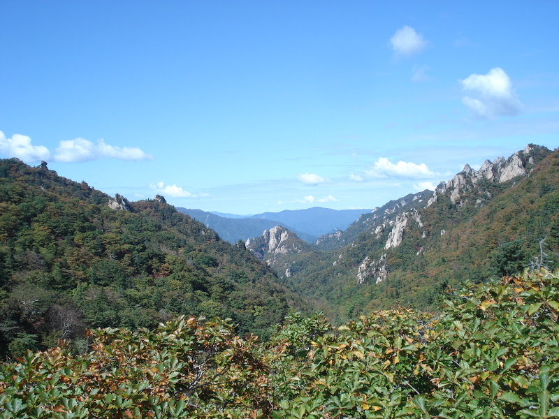
The view into the valley

Lounging on the backside.

The return trip. I just love this tree. I think I have about 20 pictures of it alone!

Sinheungsa Temple located at the Seorakdong entrance.
All in all, the whole route took us about 3h30, and after a delicious meal at one of the local restaurants, it was time to rest in preparation for the morrow.


A great stone seated Buddha, also located at the Seorakdong entrance.

Hiking the Cheonbuldong Valley. Lots of stairs were involved.

This portion of the route followed a river (stream?) with a pleasing number of small waterfalls and rapids.

Heading up! 

One of the lovely views.

I loved the play of light on this fallen tree.

And just the fall colours in general. We really couldn't have asked for better weather.

Crags! That's the East Sea (Sea of Japan) over there in the background.


The view from atop a crag (this is what happens when you hike with rock climbers).

Beauty.

Looking down into the valleys.

And over toward the mountainous north. I'd say that the furthest mountains are likely to be (at the very least)  in the DMZ.

At the 9.8km point.

Fall colours.
To say it got a bit foggy is probably and understatement.

The view from the top.

Descending into Osaek.
Since none of us were quite ready to return to Gwangju just yet, we decided to catch a later bus back the following day and spend the morning and early afternoon enjoying the city and the beach.

Sunning on the rocks by Yeongnangho lake. That's Ulsanbawi you can see in the right-hand portion of the background and Daecheongbong to the left.

The lovely (and somewhat chilly at this time of year) Sokcho beach.

A final view.