From the smallest to the largest. Last weekend I had the opportunity to hike across the 41km that comprises the spine of Jirisan (지리산 - Jiri Mountain) National Park. This to be contrasted with this weekend, which I spent largely doing nothing while lounging around my house reading novels ;).
 |
| The colours of the Hwaeom (화엄) Valley where we began our ascent. |
While the original plan had us hiking as a party of six, only two of us wound up actually doing the hike (the two boys dropped out early in the planning due to 'other commitments' and the other two girls unfortunately fell ill the week before). While I admit, the prospect of traversing 41km (46 actually if you consider the hike up to the trail head from our hotel and then down again into the village bus station at the other side) and 13 different peaks in only two days might be a little daunting, it was totally worth it - especially with all the colours showing at this time of year!
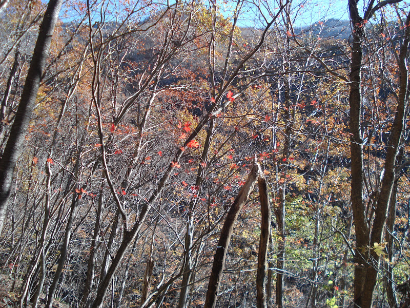
 |
| The colours along the road up to the Hwaeomsa (화엄사 - Hwaeom Temple) entrance. |
Due to the time constraints imposed by having to work during the week, we decided to head out from the Hwaeomsa entrance at the western side of the park and hike eastward, ending our trek either at Daewon Temple (대원사) or at Jungsanni (중산니) in the east. This made it possible to hop on a bus from Gwangju to Gurye (구례) (1h30) on the Friday night and to take a cheap 6,000won taxi ride out to our pension near the temple for the night. (We had a Nore Taxi!(Korean kareoki) It was epic!) For the record, the Hwaeom Pension is great, hugely spacious, nice rooms with cooking facilities at very decent prices (less than 20,000/person). The rooms are traditional ondol-style (heated floor with blankets).
 |
| Hwaeomsa at roughly 7:15am. |
We set out bright and early on the Saturday morning with the intention of trekking up to Hwaeomsa for a quick visit and then heading ownward from there. The 7km up from Hwaeomsa to Nogodan (1,430m) was arguably the hardest part of the trek. Beautiful, but hard. I'd previously seen it described as a 'long, slow slog' and when we started out, we thought that might be a bit of an exaggeration. It wasn't. If you want an easier route in, I recommend the 4.7km up from the Seongsamjae (성삼재) Pass.
 |
| This was a nice, un-evil, part of the path. |
 |
| Getting even more beautiful as we rise... |
 |
| Above to the point at which the trees have lost all their leaves. |
 |
| The morning view from Nogodan (노고단) (1,430m). |
 |
| Check out those clouds. |
 |
Walking the Dwaejiryeong Pass (돼지령).
|
 |
| Looking over the Piagol Valley (피아골). |
 |
| At the top of Samdobong (삼도봉), or Three Province Peak (1499m), so named because it represents the intersection of three of the Korean provinces - Jeollanam-do (전라남도), Jeollabuk-do (전라북도) and Gyeongnam-do (경남도). |
 |
| Around mid-morning. Happy to have made it thus far! |
 |
| The view southeast from Samdobong (I believe that this is the Baemsagol Valley (뱀사골)). |
 |
| Heading toward Tokkibong (토끼봉). |
From here on out, the route got much rockier - Hilary described it best as "the ultimate rock playground". So much fun! Ideal for those who like scrambles. The route also remained an awesome ridge walk for much of the rest of the trek to the highest peak, Cheonhwangbong (천황봉), the next day.
 |
| Just stunning. |
 |
| I just couldn't resist. Something was definitely added by the drying flora at the top. |
 |
| Look! It's Grandmother Willow's stony cousin in the background! |
 |
| Heading down from one of the final peaks of Day 1 (I believe it was Hyeongjebong (형제봉).). |
 |
| The view as the sun begins to go down (it was about 4:30 pm). |
 |
| There was just something about this tree. |
Once we realised how close we were to Byeoksoryeong Shelter (벽소령 대피소) where we planned to stay the night, we decided to dawdle a bit more and take our time on the paths. We finally made it to the shelter around 5:45pm, just before full dark, after roughly 10 and a half hours of hiking with minimal 5-10 minute breaks to see the peaks or munch on some food. We covered roughly 24km in that time. The shelter itself was a lot nicer than we'd expected (especially once you get used to smelling the toilet smell that emanates from the restrooms near all Korean mountain shelters). It was supremely warm, rooms were split by gender, and for an extra 3,000won (reservation was 8,000), we were able to get 3 blankets each (one to sleep on, one to sleep under, and one to use as a pillow). Lights out was around 10pm, with most of the other guests (particularly those without reservations sleeping in the lobby), waking up at 4:30am to recommence their hikes in the dark. We decided to set out at the much nicer hour of 6:30am.
 |
The view from Deokpyeongbong (덕평봉) as the sun rises.
|
 |
| While we'd known from the outset that Sunday was going to be rainy, there's nothing quite like watching the rain you're about to be hit by as it rolls in. |
 |
| Valley view somewhere along the nearly 10km between Byeoksoryeong and Jangteomok Selters. |
 |
| Entering the cloud banks. It was so windy at the top! Crossing saddles involved trying desperately not to be blown off the mountain entirely! |
 |
| A bluebird on the steps. This was on the sheltered northern side of a peak. There were far more birds, awesome flora and fauna in general at Jiri than I have seen in any of the other parks. Jiri is also famous for being the home of the only wild Korean Blackbears left in the country. |
 |
| While ridge walks provide beautiful views on sunny days, they are nothing short of cold in the wind and the rain! |
 |
| SNOW! We also encountered hail. |
 |
| The last bit to the top! The second half of the last 1.5km from Jangteomok Sheter (장터목 대피소) to the top of Cheonhwangbong was arguably the most technically challenging - particularly in the inclement weather - it was also the most fun. Much more like rock climbing/scrambling than traditional hiking. |
 |
| Hilary and I at the top! Cheonhwangbong (천황봉) is Jiri's highest peak at 1915m above sea level - it's also the highest on the Korean mainland - WOOT! This pic gives you some idea of the level of visibility at the top. We got here around noon. |
Having seen the weather at the top and knowing what we would be heading into further down, we decided to take the shorter 5.4 km route down to the Jungsanni (중산니) park exit (the route to Daewonsa would have been 11.7km, plus 2 more into town), where we could hop on a bus into Jinju and, from there, catch the 2hour bus back to Gwangju. Rather entertainingly, we accidentally took a detour which added 3.4km on to the route (and still had to walk another 2km from there to the bus station). Fortunately, the detour proved to be a spectacular river-valley descent and we were so wet from the rain at this point that it really didn't matter (not only were we soaked through, so was nearly everything in our bags that wasn't bagged itself - my backpack was dripping!).
 |
| A beautiful temple entrance about halfway between Cheonwhangbong and the Rotari Shelter (로타리 대피소) on the way down. |
 |
| Descending into some colour. Sadly, my camera was also soaked through at this point, making it difficult to capture the vividness of the leaves. |
Overall a supremely amazing hike. Definitely well worth it - and definitely, no matter what the Koreans say, do-able as a two day journey. Oddly, to my mind atleast, we seemed to be the only ones doing the full route! Many of the Koreans we met - even those staying the night - expressed surprise at how far we were hiking, and we met no other foreigners. I definitely recommend it though. I want to go back!
 |
| Hike completed! |
A few recommendations, if you are planning to hike Jirisan (or any of the other major mountains/national parks in Korea), definitely check out
Korea in the Clouds for route, shelter and entrance info.
Another important site to check when hiking any of the national parks is the Korea National Park Website. Although it doesn't contain detailed trail maps, it does provide some idea of route lengths and difficulties. More importantly, it offers a free, English language mountain shelter booking service. Booking is made available at 10am 15days prior to the desired day. They book up within minutes, so be ready right away.
It's also important to note that, as with the other mountains, food buying options are severely limited after you ascend. Many of the shelters en route carry snacks such as water bottles (which you can refill at springs throughout the hike), chocolate bars, crackers and dry ramyeon, they do not, however, offer cooking or heating facilities. Any food you plan to eat (and anything you plan to use to cook it with such as gas, camp stoves, and plates) must be carried with you both up and down the mountain. With a
Jirisan hike, it is especially important to
pack what you plan to eat as, unlike the entrances to many of the other mountains,
there is no where to pick up kimbap or other easily transportable, non-cook food. We found this out the hard way. Fortunately for us, the kimbap was just meant to add variety, we packed more than enough food to last.
 |
| Our route map. We crossed the spine. |